Continent Europe — free printable diagram
Free geography resource for teachers · CC BY-NC 4.0
About this illustration
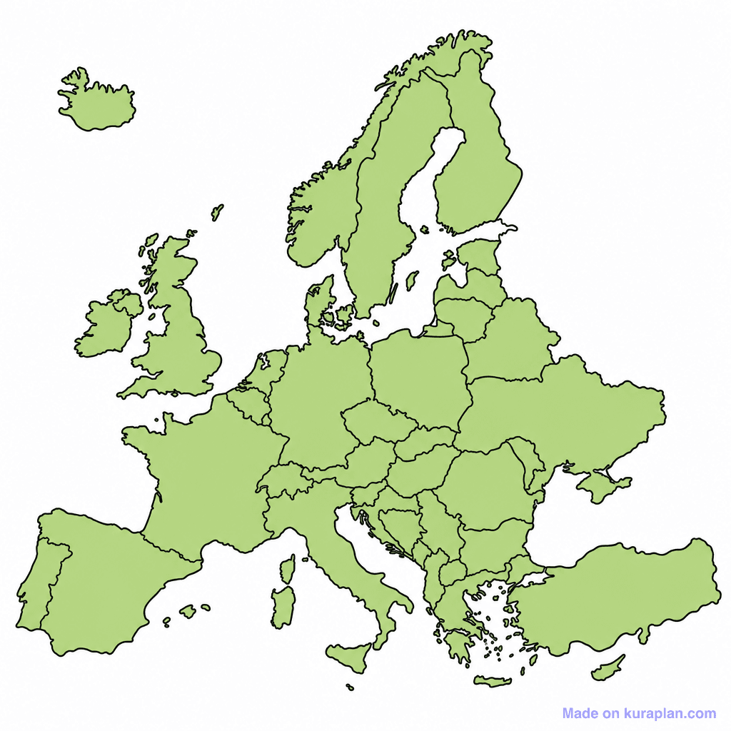
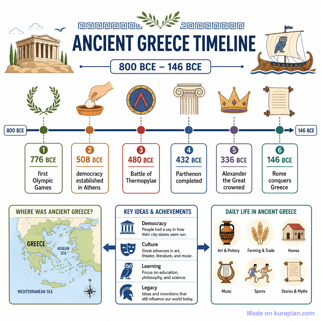
This image presents a blank political map of Europe, featuring light green landmasses with prominent black outlines denoting national borders. It is designed to teach geography, specifically the political divisions and countries of the European continent. This resource is excellent for UK, US, and international K-12 curricula. It suits classroom activities such as 'label the countries' worksheets, slide presentations for identification practice, or even coloring exercises. The visual style is a clear, flat outline illustration suitable for educational purposes. It's explicitly a blank template designed for student input.
How to use
- 1Right-click the image and choose “Save image as”, or use the download button.
- 2Use it in your classroom worksheets, slides or printables — free under CC BY-NC 4.0.
- 3Attribute as “Image by Kuraplan” or link back to kuraplan.com. Not for commercial resale.
Make worksheets with images like this
Kuraplan's editor has the full image library built in — drag-and-drop into a worksheet in seconds.
Related illustrations
More from Continent Outlines

Browse by subject
18 subjects · 5,159 free illustrations
Maths
1,912 free illustrations

Cross-Curricular
839 free illustrations

Science
818 free illustrations
English
625 free illustrations

Health
201 free illustrations
social_studies
178 free illustrations

Religious Education
140 free illustrations
Music
130 free illustrations
Art
66 free illustrations

Drama
56 free illustrations
social_sciences
48 free illustrations
History
47 free illustrations

arts
26 free illustrations

pe
25 free illustrations
te_reo_maori
24 free illustrations

tech
16 free illustrations

culture
7 free illustrations

languages
1 free illustrations