Globe — Latitude and Longitude (simple) — free printable diagram
Free social_sciences resource for teachers · CC BY-NC 4.0
About this illustration
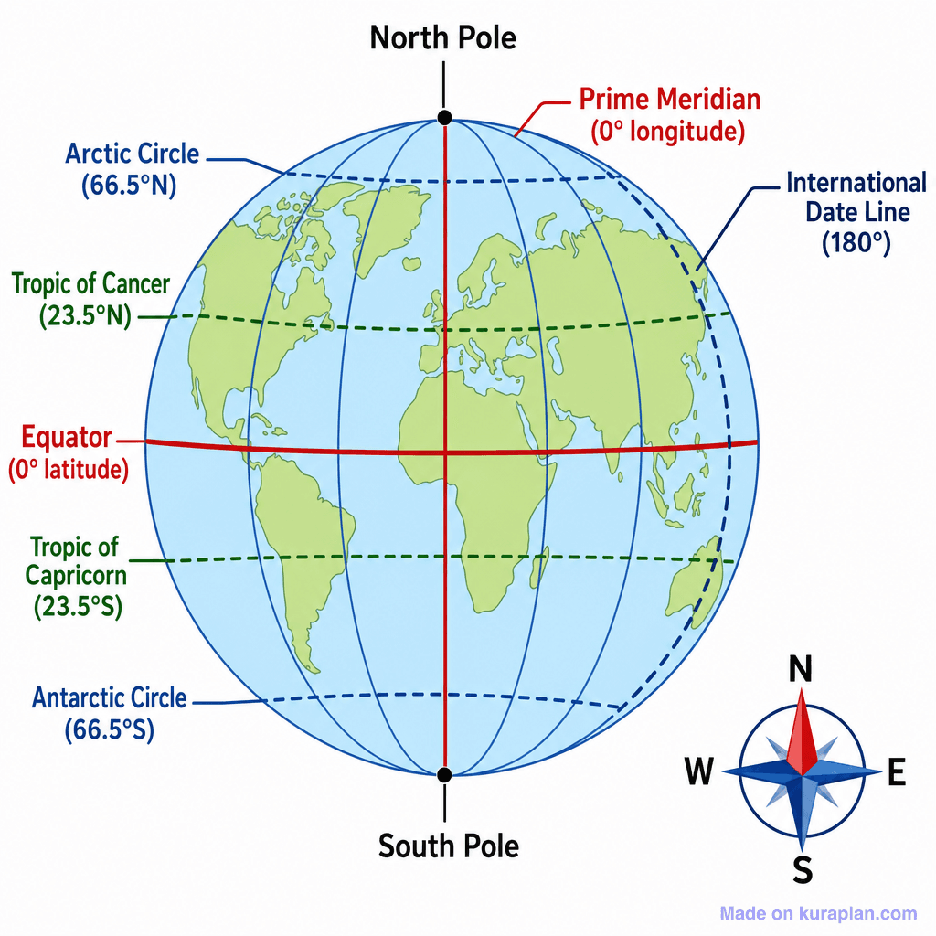
A simple labeled globe diagram showing major lines of latitude and longitude. The globe displays recognizable continental outlines. Key parallels (Arctic Circle, Tropic of Cancer, Equator, Tropic of Capricorn, Antarctic Circle) are shown as horizontal dashed or solid lines in blue and green, with the Equator in red. The Prime Meridian is shown as a vertical red line and the International Date Line as a dashed blue line on the right side of the globe. North Pole and South Pole are labeled at top and bottom. A compass rose is shown in the bottom right corner.
How to use
- 1Right-click the image and choose “Save image as”, or use the download button.
- 2Use it in your classroom worksheets, slides or printables — free under CC BY-NC 4.0.
- 3Attribute as “Image by Kuraplan” or link back to kuraplan.com. Not for commercial resale.
Make worksheets with images like this
Kuraplan's editor has the full image library built in — drag-and-drop into a worksheet in seconds.
Browse by subject
18 subjects · 5,664 free illustrations
Maths
1,912 free illustrations
Cross-Curricular
839 free illustrations

Science
818 free illustrations
English
625 free illustrations
Geography
553 free illustrations

Health
201 free illustrations
social_studies
178 free illustrations

Religious Education
140 free illustrations
Music
130 free illustrations
Art
66 free illustrations

Drama
56 free illustrations
History
47 free illustrations

arts
26 free illustrations

pe
25 free illustrations

te_reo_maori
24 free illustrations

tech
16 free illustrations

culture
7 free illustrations

languages
1 free illustrations