
Regional / Political Subdivisions — free clipart & diagrams
5 free printable regional / political subdivisions diagrams, clipart and worksheet images for geography teachers.
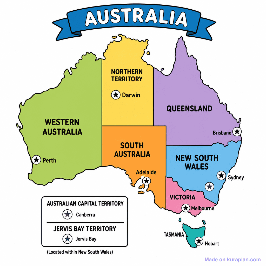
Au States Territories
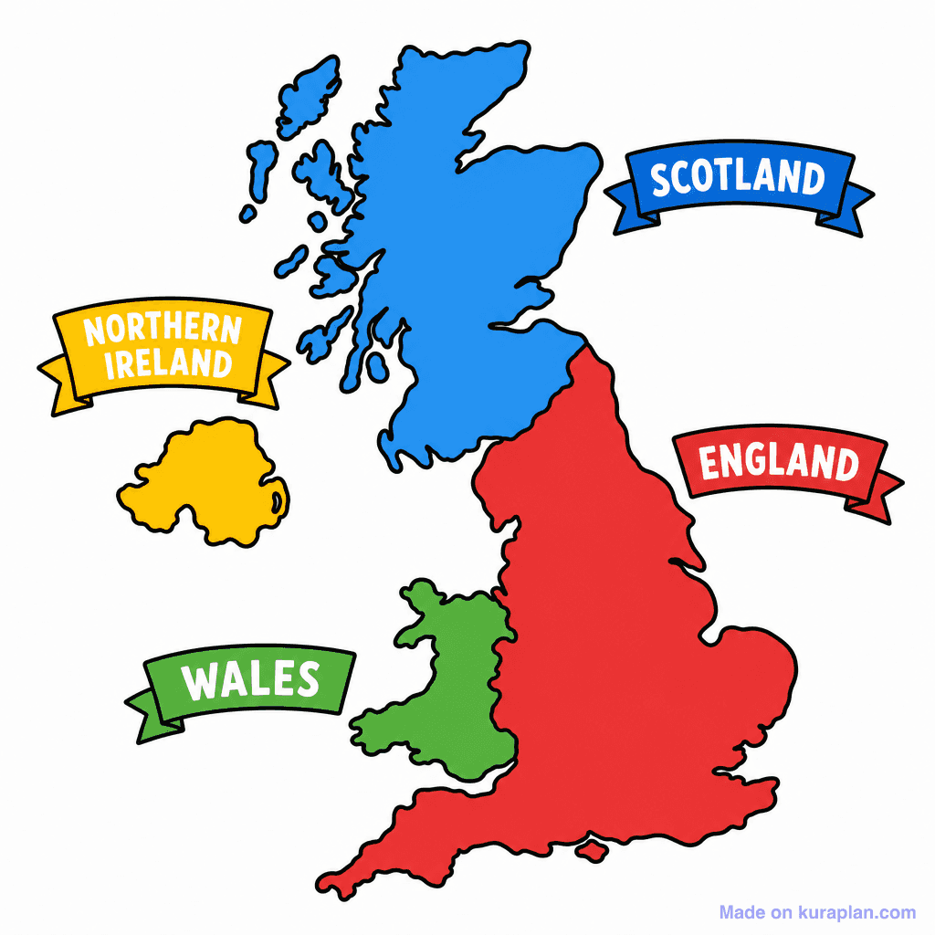
Uk Four Countries
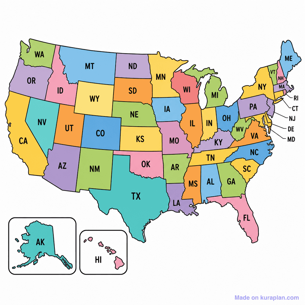
Us States 50
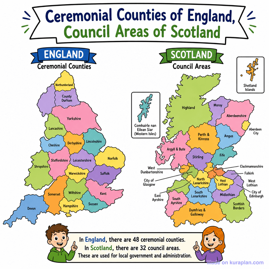
Uk Counties Ceremonial
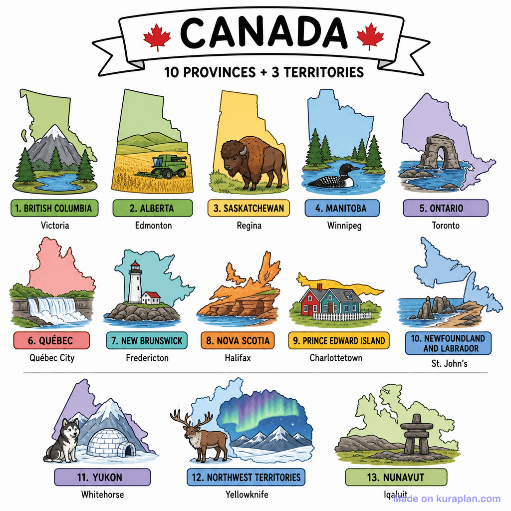
Canada Provinces Territories
Showing 5 featured illustrations from 5 total
Browse by subject
18 subjects · 5,127 free illustrations
Maths
1,900 free illustrations
Cross-Curricular
835 free illustrations
Science
816 free illustrations
English
615 free illustrations
Health
200 free illustrations
social_studies
177 free illustrations
Religious Education
139 free illustrations
Music
129 free illustrations
Art
66 free illustrations
Drama
56 free illustrations
social_sciences
48 free illustrations
History
47 free illustrations
arts
26 free illustrations
pe
25 free illustrations
te_reo_maori
24 free illustrations
tech
16 free illustrations
culture
7 free illustrations
languages
1 free illustrations