Urban Burgess Concentric Model — free printable diagram
Free geography resource for teachers · CC BY-NC 4.0
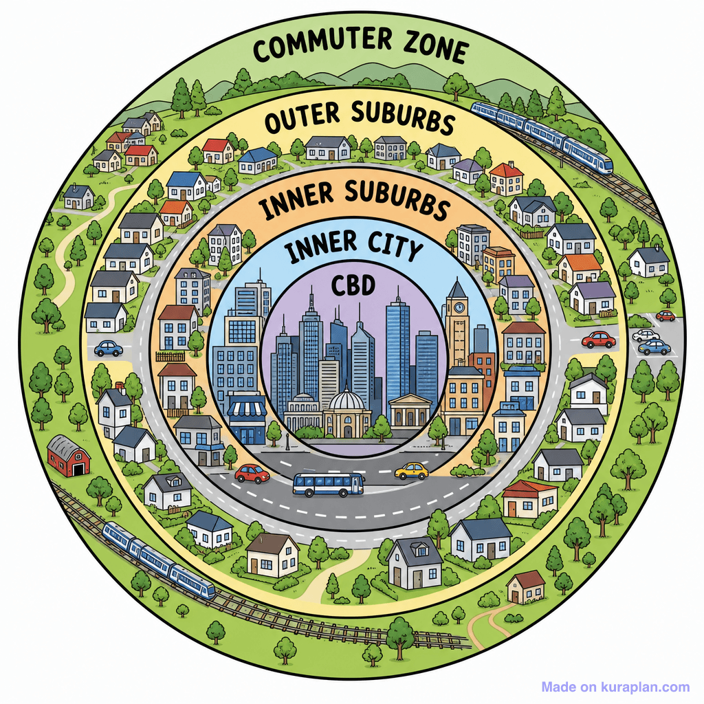
About this illustration
This flat, cartoon-style illustration depicts a concentric zone model of a city, showing distinct urban layers from the center outwards. It visually represents the Central Business District (CBD) with skyscrapers, followed by the Inner City, Inner Suburbs, Outer Suburbs, and finally the Commuter Zone, each with characteristic buildings, roads, and transportation like trains and buses. This image is ideal for teaching urban geography, human settlements, and city structure models in social studies or geography classes. It can be used for classroom slides to explain urban planning concepts, on worksheets for discussion, or as a reference for labeling exercises. There are no specific cultural or locale cues, making it suitable for a general Western context.
How to use
- 1Right-click the image and choose “Save image as”, or use the download button.
- 2Use it in your classroom worksheets, slides or printables — free under CC BY-NC 4.0.
- 3Attribute as “Image by Kuraplan” or link back to kuraplan.com. Not for commercial resale.
Make worksheets with images like this
Kuraplan's editor has the full image library built in — drag-and-drop into a worksheet in seconds.
Related illustrations
More from Settlement & Urban

Browse by subject
18 subjects · 5,127 free illustrations
Maths
1,900 free illustrations
Cross-Curricular
835 free illustrations
Science
816 free illustrations
English
615 free illustrations
Health
200 free illustrations
social_studies
177 free illustrations
Religious Education
139 free illustrations
Music
129 free illustrations
Art
66 free illustrations
Drama
56 free illustrations
social_sciences
48 free illustrations
History
47 free illustrations
arts
26 free illustrations
pe
25 free illustrations
te_reo_maori
24 free illustrations
tech
16 free illustrations
culture
7 free illustrations
languages
1 free illustrations