Water Table Aquifer Diagram — free printable diagram
Free geography resource for teachers · CC BY-NC 4.0
About this illustration
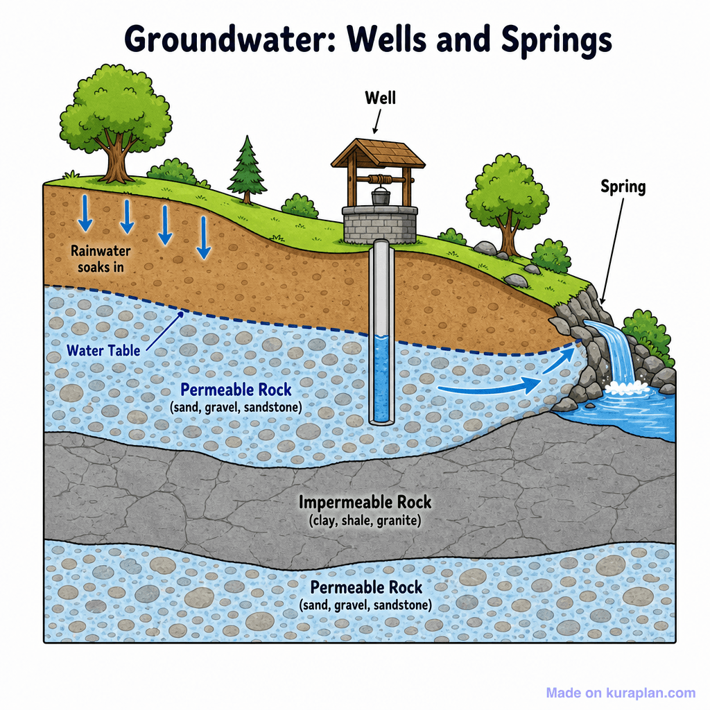
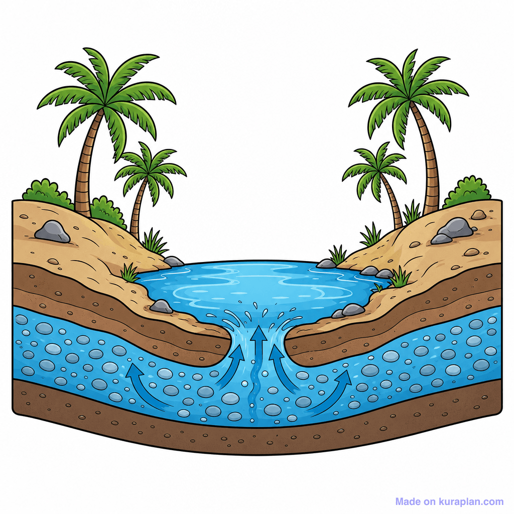
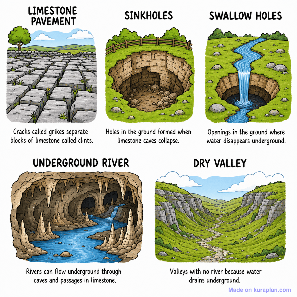
This flat illustration diagram shows a cross-section of the Earth's layers depicting groundwater, wells, and springs. It illustrates how rainwater soaks into permeable rock, forms a water table, and is accessed by a well or emerges as a spring when encountering impermeable rock layers. The diagram labels 'Rainwater soaks in', 'Water Table', 'Permeable Rock' (with examples like sand, gravel, sandstone), 'Impermeable Rock' (with examples like clay, shale, granite), 'Well', and 'Spring'. This image is suitable for teaching Earth science concepts related to hydrology and water resources in classroom slide presentations or as a labeling exercise on a worksheet.
How to use
- 1Right-click the image and choose “Save image as”, or use the download button.
- 2Use it in your classroom worksheets, slides or printables — free under CC BY-NC 4.0.
- 3Attribute as “Image by Kuraplan” or link back to kuraplan.com. Not for commercial resale.
Make worksheets with images like this
Kuraplan's editor has the full image library built in — drag-and-drop into a worksheet in seconds.
Related illustrations
More from Deserts, Glaciers, Caves
Browse by subject
18 subjects · 5,162 free illustrations
Maths
1,914 free illustrations

Cross-Curricular
839 free illustrations

Science
818 free illustrations

English
626 free illustrations

Health
201 free illustrations

social_studies
178 free illustrations

Religious Education
140 free illustrations
Music
130 free illustrations
Art
66 free illustrations

Drama
56 free illustrations
social_sciences
48 free illustrations

History
47 free illustrations
arts
26 free illustrations

pe
25 free illustrations

te_reo_maori
24 free illustrations

tech
16 free illustrations

culture
7 free illustrations

languages
1 free illustrations