Waterfall Formation Diagram — free printable diagram
Free geography resource for teachers · CC BY-NC 4.0
About this illustration
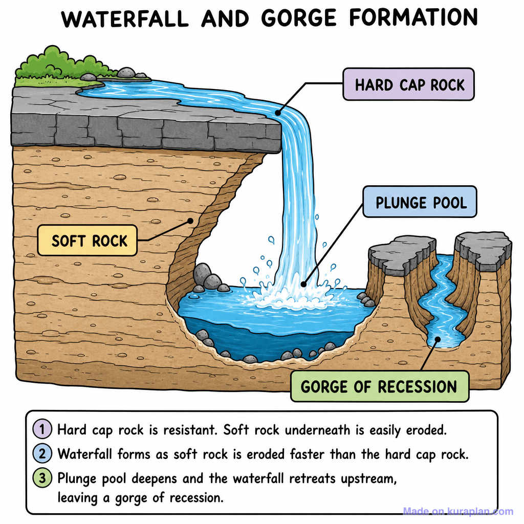
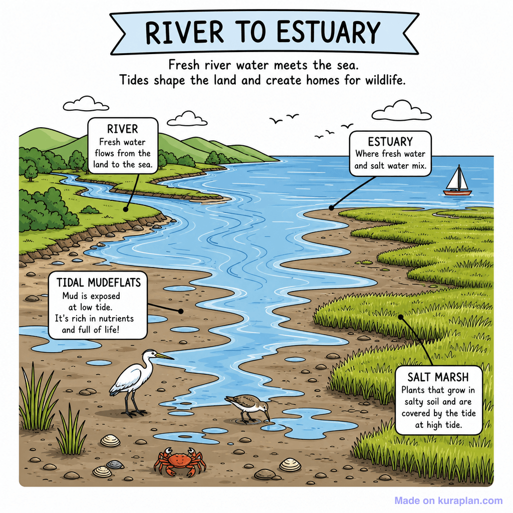
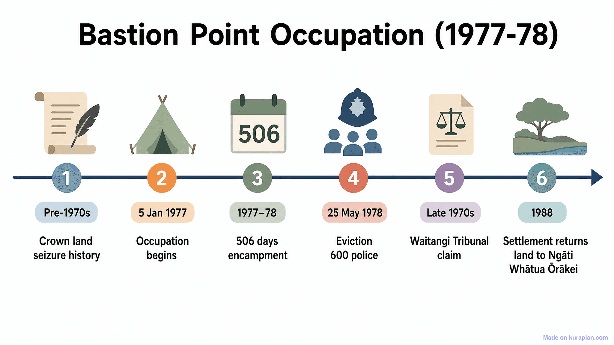
This educational diagram illustrates the geological process of waterfall and gorge formation. It depicts a cross-section of land showing a river flowing over a 'Hard Cap Rock' layer, which is resistant to erosion, and a 'Soft Rock' layer underneath, which erodes more easily. The diagram labels key features like the 'Plunge Pool' at the base of the waterfall and the 'Gorge of Recession' that forms as the waterfall retreats upstream, accompanied by a numbered explanation of the process. This visual is ideal for K-12 geography or Earth science lessons, suitable for display on slides, inclusion in worksheets as an explainer, or for label exercises. The visual style is a clear, full-color flat illustration with distinct labels.
How to use
- 1Right-click the image and choose “Save image as”, or use the download button.
- 2Use it in your classroom worksheets, slides or printables — free under CC BY-NC 4.0.
- 3Attribute as “Image by Kuraplan” or link back to kuraplan.com. Not for commercial resale.
Make worksheets with images like this
Kuraplan's editor has the full image library built in — drag-and-drop into a worksheet in seconds.
Related illustrations
More from Rivers & Water Features
Browse by subject
18 subjects · 5,168 free illustrations
Maths
1,915 free illustrations

Cross-Curricular
839 free illustrations

Science
822 free illustrations

English
626 free illustrations

Health
201 free illustrations
social_studies
178 free illustrations

Religious Education
140 free illustrations
Music
131 free illustrations

Art
66 free illustrations

Drama
56 free illustrations

social_sciences
48 free illustrations

History
47 free illustrations

arts
26 free illustrations

pe
25 free illustrations
te_reo_maori
24 free illustrations

tech
16 free illustrations
culture
7 free illustrations

languages
1 free illustrations