World Plate Tectonics — free printable diagram
Free geography resource for teachers · CC BY-NC 4.0
About this illustration
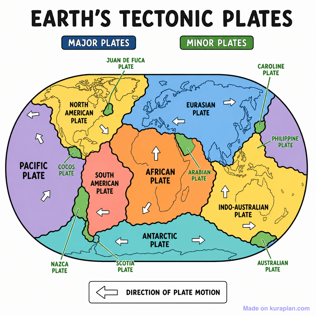
A flat illustration depicting a global map of Earth's tectonic plates, differentiated by color and labeled with their names like 'Pacific Plate' and 'Eurasian Plate'. White arrows on each plate indicate the direction of plate motion, and a clear legend distinguishes between 'Major Plates' (blue text) and 'Minor Plates' (green text). This image teaches the educational concept of plate tectonics, showing the major and minor lithospheric plates that make up Earth's surface and their movements. It is suitable for a slide presentation, a worksheet reference, or a label exercise in Earth science and geography classrooms, particularly in K-12 settings globally. The visual style is a clear, high-contrast, flat illustration of a world map diagram.
How to use
- 1Right-click the image and choose “Save image as”, or use the download button.
- 2Use it in your classroom worksheets, slides or printables — free under CC BY-NC 4.0.
- 3Attribute as “Image by Kuraplan” or link back to kuraplan.com. Not for commercial resale.
Make worksheets with images like this
Kuraplan's editor has the full image library built in — drag-and-drop into a worksheet in seconds.
Related illustrations
More from World Maps (Thematic)


Browse by subject
18 subjects · 5,159 free illustrations
Maths
1,912 free illustrations
Cross-Curricular
839 free illustrations

Science
818 free illustrations
English
625 free illustrations

Health
201 free illustrations
social_studies
178 free illustrations

Religious Education
140 free illustrations
Music
130 free illustrations
Art
66 free illustrations

Drama
56 free illustrations
social_sciences
48 free illustrations
History
47 free illustrations

arts
26 free illustrations

pe
25 free illustrations

te_reo_maori
24 free illustrations

tech
16 free illustrations
culture
7 free illustrations

languages
1 free illustrations