World Map 7 Continents Blank — free printable clipart
Free geography resource for teachers · CC BY-NC 4.0
About this illustration
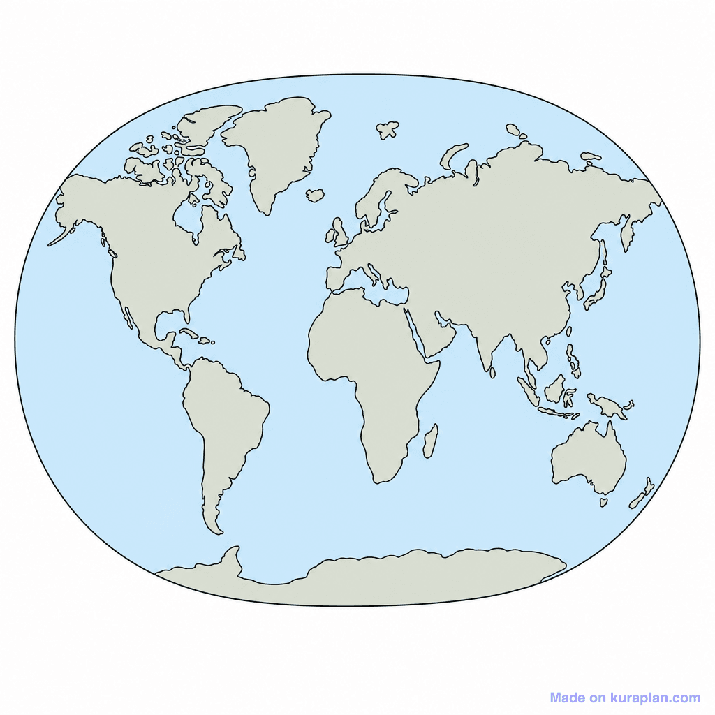
This image presents an unlabelled, elliptical world map depicting all seven continents and major landmasses in light gray, surrounded by light blue oceans, all outlined with a thin black line. It is a fundamental visual aid for teaching world geography, global regions, and the location of continents and oceans. The lack of labels makes it ideal for classroom activities such as 'label the continents' worksheets, identifying geographical features, coloring exercises, or as a base for illustrating climate zones. The visual style is a clean, flat illustration, serving as a clear diagram or template for student interaction.
How to use
- 1Right-click the image and choose “Save image as”, or use the download button.
- 2Use it in your classroom worksheets, slides or printables — free under CC BY-NC 4.0.
- 3Attribute as “Image by Kuraplan” or link back to kuraplan.com. Not for commercial resale.
Make worksheets with images like this
Kuraplan's editor has the full image library built in — drag-and-drop into a worksheet in seconds.
Browse by subject
18 subjects · 5,159 free illustrations
Maths
1,912 free illustrations
Cross-Curricular
839 free illustrations

Science
818 free illustrations
English
625 free illustrations

Health
201 free illustrations
social_studies
178 free illustrations

Religious Education
140 free illustrations
Music
130 free illustrations
Art
66 free illustrations

Drama
56 free illustrations
social_sciences
48 free illustrations
History
47 free illustrations

arts
26 free illustrations

pe
25 free illustrations
te_reo_maori
24 free illustrations

tech
16 free illustrations
culture
7 free illustrations

languages
1 free illustrations