
World Maps (Thematic) — free clipart & diagrams
12 free printable world maps (thematic) diagrams, clipart and worksheet images for geography teachers.
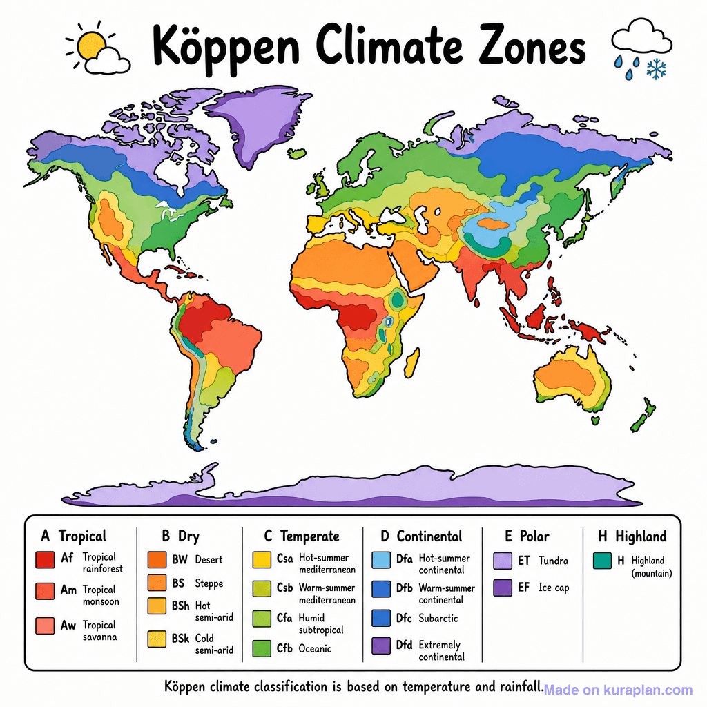
World Climate Zones
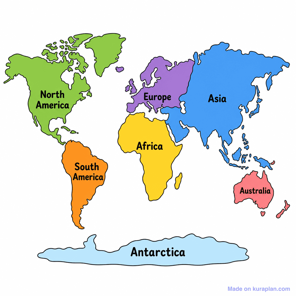
World Continents Coloured
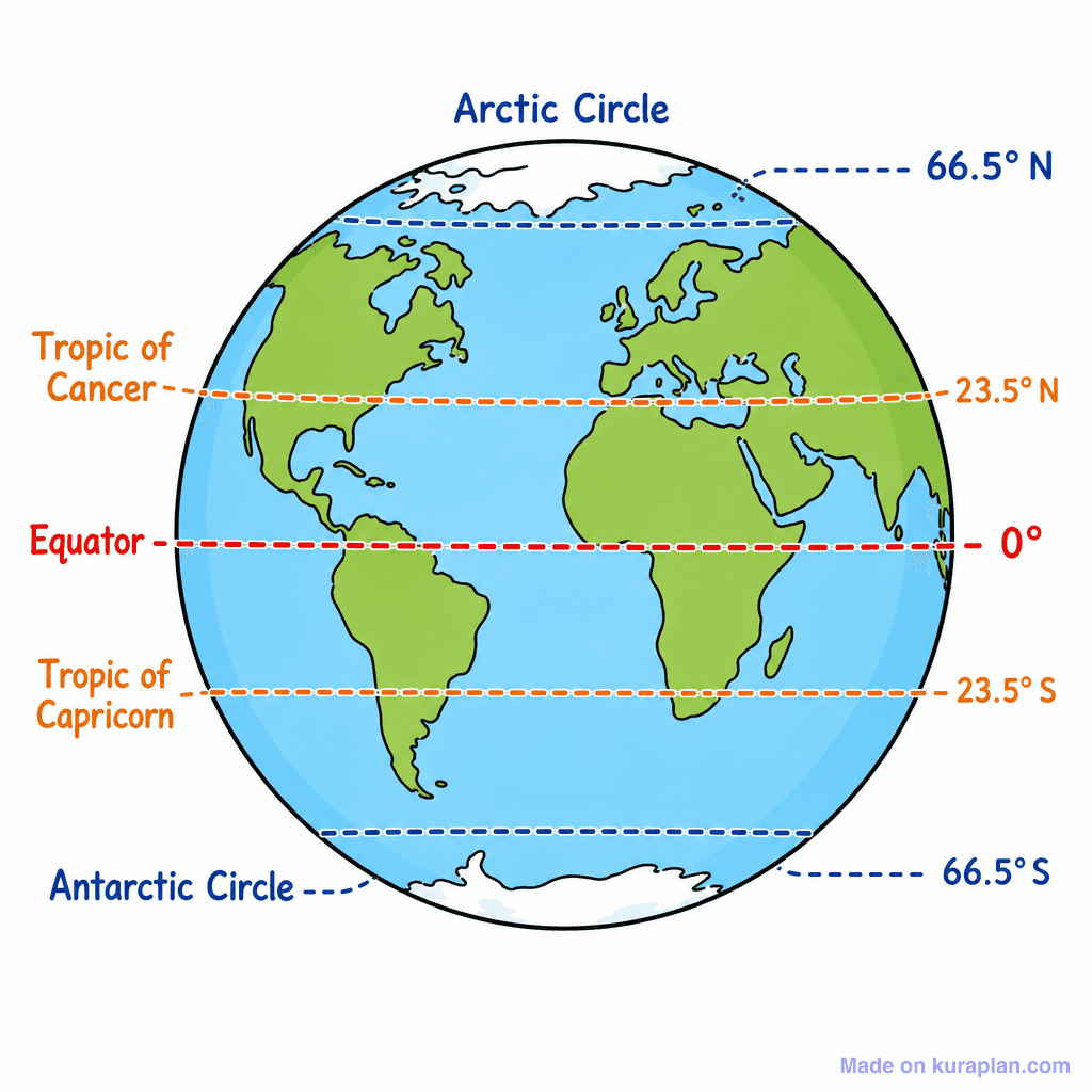
World Lines Of Latitude
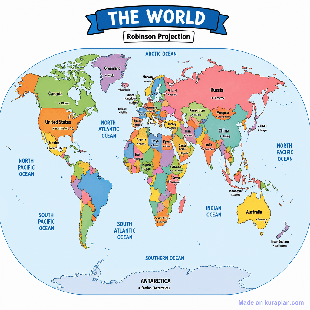
World Political Map

World Biomes Map

World Hemispheres Ns
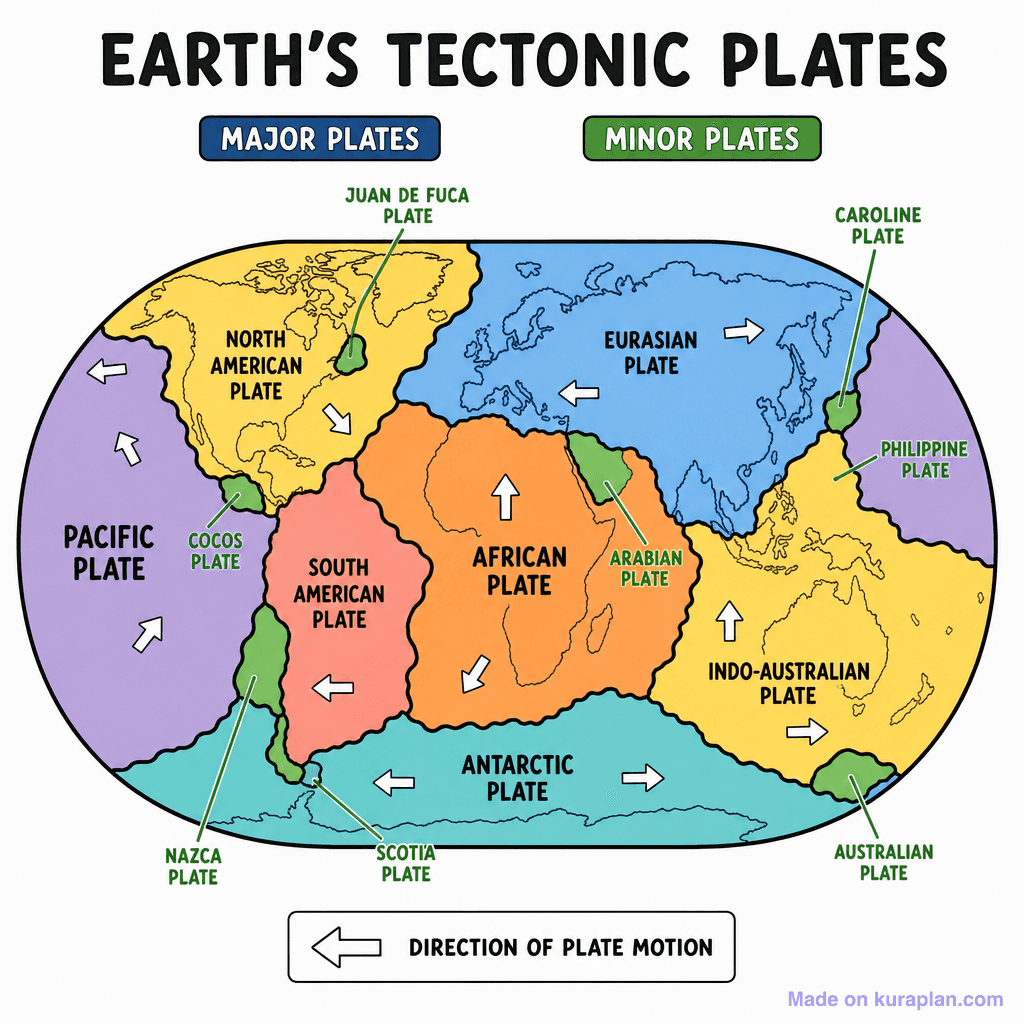
World Plate Tectonics
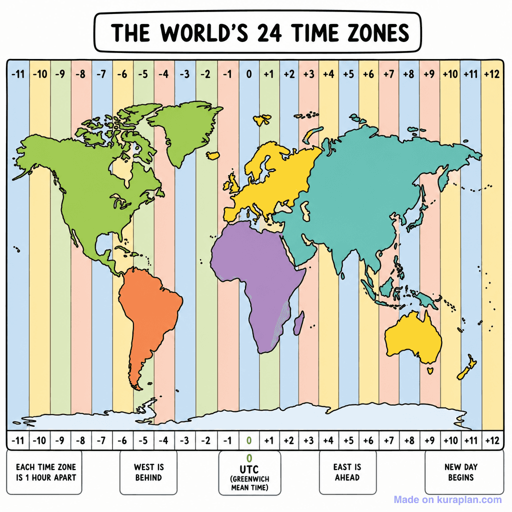
World Timezones
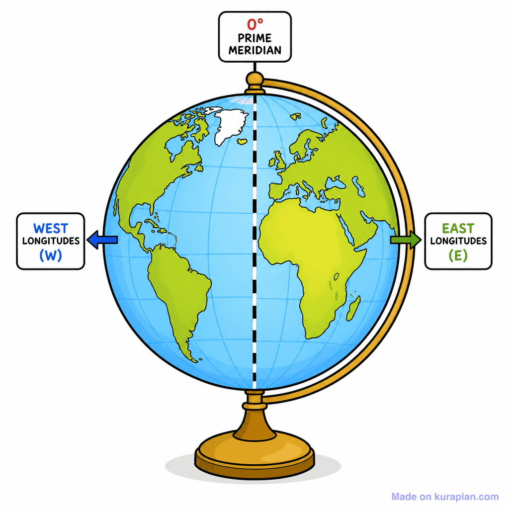
World Hemispheres Ew
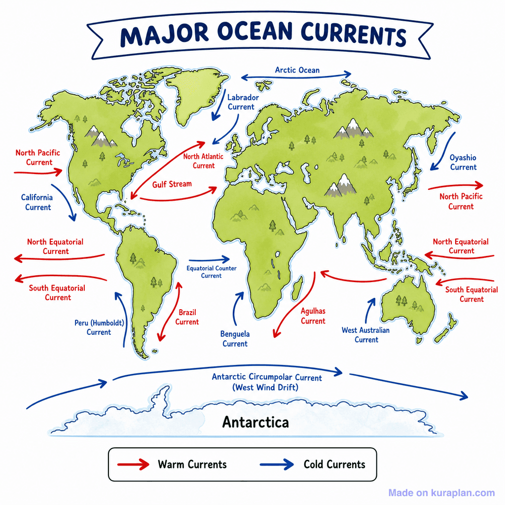
World Ocean Currents
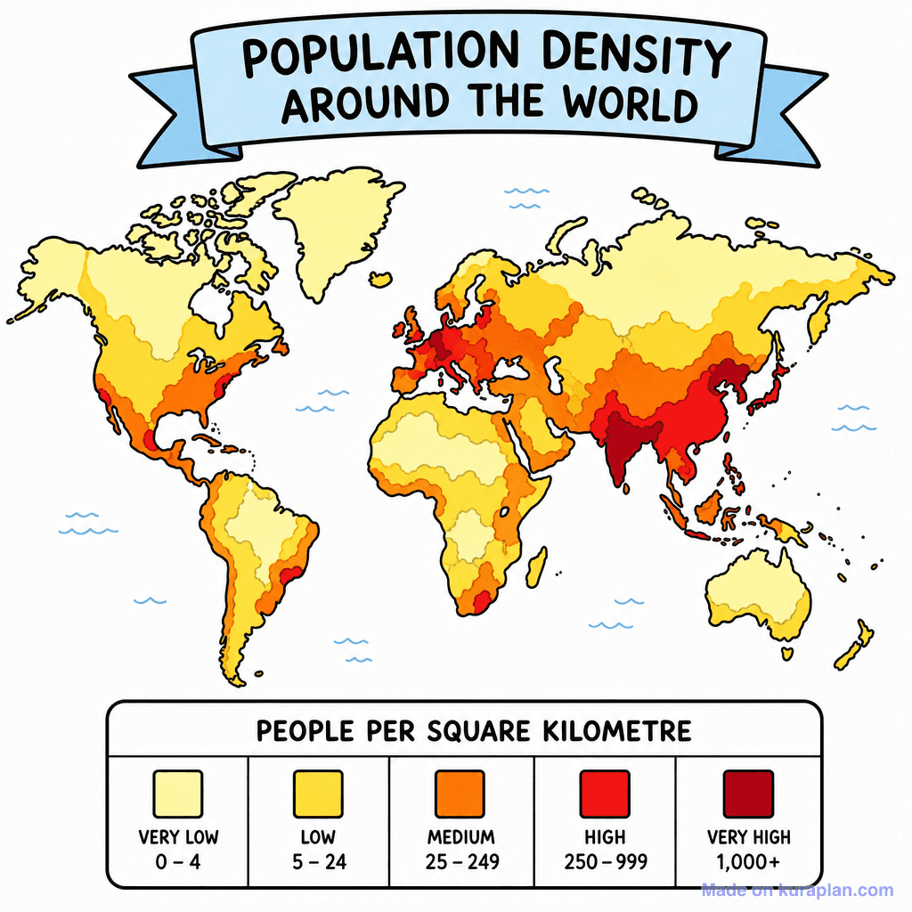
World Population Density

World Wind Belts
Showing 12 featured illustrations from 12 total
Browse by subject
18 subjects · 5,126 free illustrations
Maths
1,899 free illustrations
Cross-Curricular
835 free illustrations
Science
816 free illustrations
English
615 free illustrations
Health
200 free illustrations
social_studies
177 free illustrations
Religious Education
139 free illustrations
Music
129 free illustrations
Art
66 free illustrations
Drama
56 free illustrations
social_sciences
48 free illustrations
History
47 free illustrations
arts
26 free illustrations
pe
25 free illustrations
te_reo_maori
24 free illustrations
tech
16 free illustrations
culture
7 free illustrations
languages
1 free illustrations